
Severe Thunderstorm Warning Issued for Salina Area
A Severe Thunderstorm Warning remains in effect for Saline County until 7:45 p.m. Saturday, according to the National Weather Service.
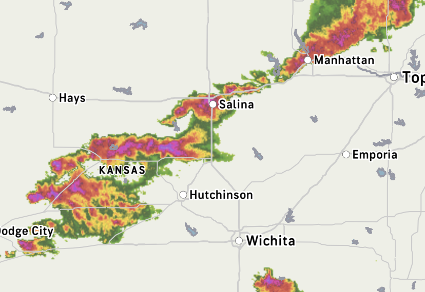
At 7:12 p.m., the storm was located near New Cambria, near Salina, and was moving east at 25 mph.
The storm is capable of producing 60 mph wind gusts and quarter-size hail. Hail damage to vehicles is expected, and wind damage to roofs, siding, and trees is possible.
Salina311 has received reports of hail, sustained winds, and heavy rain in the area. The National Weather Service also warns that torrential rainfall may lead to flash flooding.
Impacted areas include Salina, Gypsum, Brookville, Smolan, New Cambria, Glendale, Salina Airport, and Kipp. The warning also includes portions of I-135 between mile markers 83 and 95 and I-70 between mile markers 236 and 266.
Residents should move indoors, stay away from windows, and go to an interior room on the lowest floor of a building.
Drivers should avoid flooded roadways and should not attempt to drive through standing water.
A Tornado Watch remains in effect until 11 p.m. for central Kansas.